The T+E Species Search Project aims to coordinate volunteers in surveying for threatened and endangered species in the Bad River Watershed, as well as potential threats to these species and their habitats. All observations from volunteer surveyors will be added to the Bad River Watershed iNaturalist portal. The project builds from earlier work by CLEAN WI and is a collaboration with the Great Lakes Indian Fish and Wildlife Commission (GLIFWC) and the Superior Rivers Watershed Association (SRWA). In particular, the project encourages and supports community members in surveying downstream from major construction projects, which represent potential threats to these species. Please see the resources below:
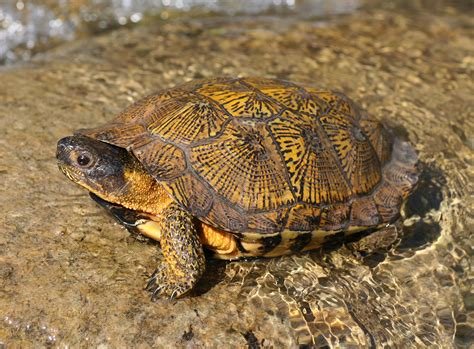
Northern Wisconsin Threatened and Endangered Species list – presentation of 59 threatened and endangered species that have been documented to live within the Bad River Watershed.
How to get involved in this project:
- Join the Bad River Watershed iNaturalist portal.
- Download the app “iNaturalist”
- Click the menu button in the app. Then click “Projects”.
- Search for “Biota of the Bad River Watershed”.
- Click “Join”.
- Now, when you are located in the Bad River Watershed bioregion, you can take photos of species you see and upload them to iNaturalist! The data collected will be seen by GLIFWC and SRWA and help them learn about and monitor the species in the area.
- Download the booklets below to learn about how to identify endangered and threatened species in the area.
- Check out the rest of this website to learn more about major construction projects in the area. Also look through the survey sites below for ideas of where to survey!
- Note: If you don’t want to use iNaturalist, you can alternatively email tne.search2@proton.me with your pictures and reportbacks from surveying. If you choose this option, please send in the following (if possible):
- Photos of the species (include metadata– location, date, etc)
- Scientific or common name
- Date observed
- Latitude/longitude
- Number of individuals
- Estimated area of population
- Location/habitat description
Download Survey Booklets:
Below are three booklets that serve as useful guides for species surveying in particular ecosystems. To print these materials at home and form them into a booklet, save each document as a PDF. In your print settings, select “Two-Sided” and “Short-Edge Binding”. Once printed, stack all pages together and staple, hole-punch, or bind the center to create your own booklet!
Surveying for Species in the Bad River Watershed: Conifer and Hardwood Swamps
Surveying for Species in the Bad River Watershed: Streamside Surveying
Surveying for Species in the Bad River Watershed: Bogs, Fens and Sedge Meadows
Survey Sites and Accessibility Notes
Below, see descriptions of various river sites where you can survey for different species. There are many more locations to survey as well; this project is focusing on any location downstream of major construction projects.
| Locati on | Coordinates | Description of site | Float description |
|---|---|---|---|
| Marengo River Road | 46°25’42.01”N, 90°50’50.49”W | This location is where the Marengo River Rd crosses the Marengo River. Ample parking on the side of the road. There is a 10-15 foot scramble underneath the bridge to get down to the river, a few thorny plants and rocky.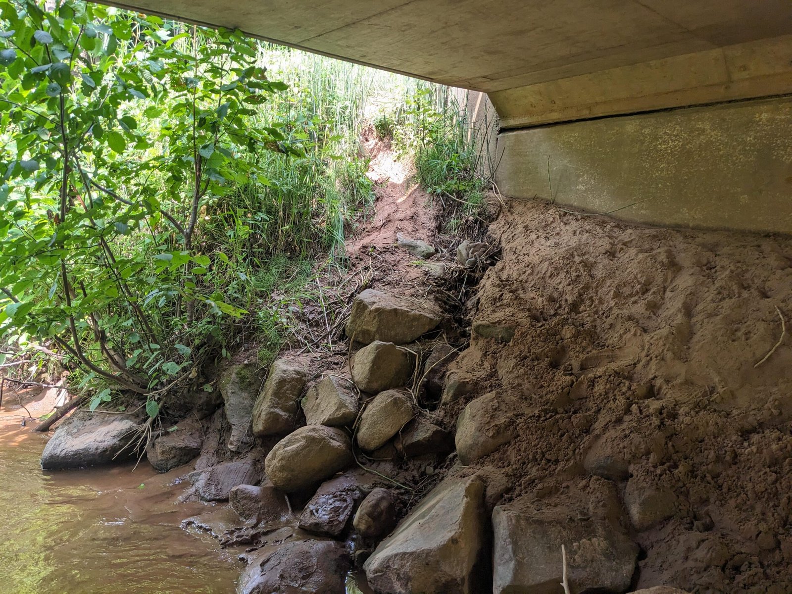 Image depicting the bridge and rocky scrabble to get down to the river | Upstream walk/paddle description:
|
| County Rd. C and Brunsweiler River | 46°24’25.04”N, 90°48’40.95”W | This is where the Brunsweiler River crosses County Rd C. After the intersection between Highway 13 & County Rd C, drive West down County Road C. Small gravel pull off area for a few cars to park. Easier access to water, but must scramble down a couple large rocks into river. | Upstream walk description: – Rocky and muddy bottom, recommend water shoes, up to hip deep, though often possible to walk on the bank – Walk upstream about 30 minute easy walk. – Lots of deadfalls – this would be difficult in a boat Many sandbars and rock bars |
| White River Dam Flowage | 46°29’53.50″N, 90°54’30.41″W | This location is just downstream of the White River Dam, where there is a long driveway and ample parking. Following the driveway to the end brings you to a small boathouse with a dock, where light watercraft can more easily enter the water. | Downstream float description: – In late June with medium water levels, float to Highway 13 bridge (coordinates: 46°31’00.0″N, 90°50’34.3″W) took roughly five hours – Highway 13 exit steep and somewhat hidden, through tall grass. Parking area on side of road can fit 3-5 cars. Sandy-bottom inlet available for “parking” watercraft. – Some rapids and rocky bottoms to traverse, no deadfalls encountered – Wide river fully traversable by canoe, deepest spots encountered about shoulder-deep – Easement located between fourth and fifth bend from boathouse put-in site: right, left, right, left, just past a house on a hill on the left bank. |
Enjoy surveying and let us know how it goes! Email tne.search2@proton.me with any reportbacks of your survey!